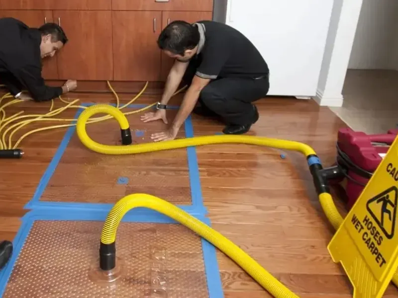
Oregon City sits on the Willamette River, and its lowest ground is a bench beside the water. The city publishes flood maps and floodplain rules, and a homeowner or business owner can use them to understand risk before a storm arrives.
Key takeaways
- Oregon City keeps floodplain rules in the Flood Management Overlay District, Chapter 17.42 of the municipal code.
- The city's OCWebMap shows the 1996 flood extent, the FEMA 100-year and 500-year floodplains, the floodway and base flood elevation.
- The Two Rivers neighborhood is the lowest part of town and is mostly commercial, including downtown.
- Water that enters a low building needs to be pumped out quickly, since the area is the lowest part of the city.
- A map shows risk but does not replace checking the actual water on the floor.
Why the lower bench behaves differently
The city is divided into a lower area on a bench beside the Willamette River and an upper area on a bluff of Canemah basalt. The Clackamas River also meets the Willamette near Clackamette Park, which is why the Two Rivers neighborhood has that name.
Two Rivers is the lowest-elevation area of town and is mostly commercial, including downtown Oregon City. Water that reaches this area has nowhere lower to go.
The city was established in 1829 by the Hudson's Bay Company and in 1844 became the first U.S. city west of the Rocky Mountains to be incorporated. That long history means many buildings along the river have seen more than one flood.
Canemah is a narrow strip of land along Oregon Route 99E between the Willamette River and a bluff. It was founded in 1845 as an independent city before annexation, and it shares the same squeezed geography.
What the city's flood tools show
The city has adopted FEMA 2008 floodplain maps. Its OCWebMap shows the flood layers in one view, and an owner can compare an address with each layer.
Comparing the layers matters because they answer different questions. One layer shows what happened in the past, while the others show chances in the future.
- The 1996 flood extent shows how far water spread in the February 1996 flood.
- The FEMA 100-year and 500-year floodplains show areas with different flood chances.
- The floodway shows the channel that carries moving water.
- Base flood elevation shows the expected height of flood water in mapped areas.
Rules that apply near water
Floodplain rules are in the Flood Management Overlay District, Chapter 17.42 of the Oregon City Municipal Code. Development near streams and wetlands also falls under a stream protection overlay, which requires a vegetated corridor along stream banks.
These rules matter after a flood too, because repairs near water can raise questions. A building owner can ask the city before rebuilding in a mapped area.
The vegetated corridor rule is a reminder that streams and wetlands are protected areas. A yard beside a creek may carry limits on what can be built or cleared, so work after a flood is best checked before it starts.
The city also keeps its own sewer and water systems. Sanitary sewer collection is run by the city, while private sewer pipes on a property are the owner's responsibility, which matters when flood water pushes sewage back through a drain.
What the history says
The city keeps a historic flood photo gallery covering floods in 1890, 1909, 1923, 1927, 1943 and 1964, plus aerial photos from February 10, 1996. The February 1996 Willamette Valley flood submerged downtown for several days and caused heavy damage there.
The pictures show water at the same streets and buildings that exist today, which is a reminder that low ground floods repeatedly.
The riverfront was once known for large paper mills on the Willamette River, and the Willamette Falls Legacy Project is converting the falls area into a public access, mixed use space. As the riverfront changes, new buildings arrive at the same low ground that has flooded before.
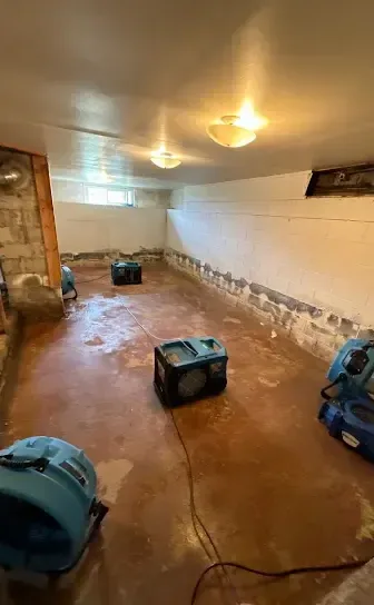
How water extraction works in a low building
When water gets inside a ground-level business or home, water extraction comes first. Pumps handle depth, and truck mounted or portable extractors take water from carpet and flooring.
The local water extraction page covers the method in more detail.
Speed matters because water spreads sideways into walls, under baseboards and into the subfloor. Every added hour gives it more material to soak.
A business in a ground floor space has an added concern, since inventory, equipment and records often sit at floor level. Moving them to higher shelves or racks before the water is out is part of the first steps.
Pumps do not remove everything. Water that soaked into drywall, wood and concrete needs the drying stage that comes after.
- Pumps lower the water level in basements and ground floors.
- Extractors pull water from carpet, pad and hard floors.
- Moisture mapping shows which walls and floors need drying.
- Contents are moved to dry areas and sorted.
- Ground floor stock and records are lifted to racks or upper floors.
From water removal to storm cleanup
If the water came from a river rise or heavy rain, the job is a storm water flood cleanup. That means removing silt, treating surfaces and removing materials that cannot be saved.
After extraction, structural drying follows, with equipment running until readings on walls and floors are normal.
The February 1996 flood followed heavy rain that had saturated the ground, then a snowstorm and deep freeze, and then a warm rain that melted the snowpack. A forecast that matches that sequence is worth taking seriously.
Silt is the other half of a river flood. It settles on floors and in wall bases, and it is removed before drying equipment is set so the machines are not drying mud.
Using the maps before a storm
A map check takes a few minutes and can change what an owner does before the next wet season.
Business owners can also check where deliveries and equipment are stored. A forklift battery, a server rack or boxes of paper on the floor all take losses when water arrives.
Neighbors in the same area often share the same risk, so a conversation with adjacent businesses about shared drains, loading docks and storage can reveal problems early.
- Look up the address on OCWebMap and note which layers apply.
- Move records and electronics off floors in mapped areas.
- Photograph the building and contents for insurance.
- Keep a list of shutoff locations for water, gas and power.
Questions
Where does Oregon City keep its flood information?
The city's OCWebMap shows the 1996 flood extent, the FEMA 100-year and 500-year floodplains, the floodway and base flood elevation.
Which part of town is the lowest?
The Two Rivers neighborhood is the lowest-elevation area and is mostly commercial, including downtown Oregon City.
What rules cover floodplain building?
Floodplain rules are in the Flood Management Overlay District, Chapter 17.42 of the Oregon City Municipal Code.
Why does water need to be removed quickly?
Water spreads into walls, subfloors and contents. Fast removal limits how far it travels.
Do the maps replace a site check?
No. A map shows risk, but the actual damage is found by reading moisture in the building.